
Whitecliffs (Rye to Blairgowrie) Bay Trail
ID: 5f2a297d68a1e8f647234ca8Rye, Rye, Victoria
Rye,
Victoria
3941.
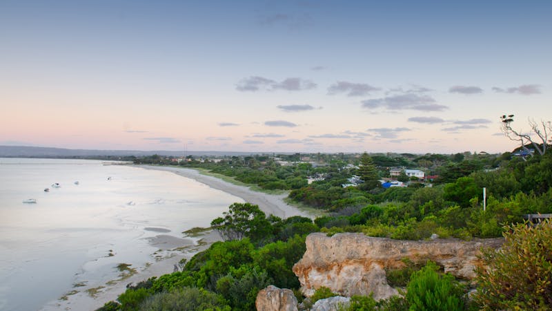
An easy walk along the foreshore from Rye Pier to Canterbury Jetty Road. About a kilometre to the west of Rye Pier is White Cliffs - a rocky cliff outcrop on a small hill. At the base of the outcrop is a reconstructed Lime Burners Kiln that was built as a tribute to one of the major industries for the early settlers in the Rye area. During the mid 1800's, natural limestone was mined in the Rye area. It was then burnt in kilns such as this, to turn it into lime which was then shipped to Melbourne for use in the building industry. The last commercial burning of lime on the Peninsula was carried out in the Rye area. From the reconstructed Limeburners kiln, there are steps leading to a lookout area at the top of the cliff, and while it is probably less than one hundred feet high, the views both to the East towards Arthur's Seat and West towards Blairgowrie are quite stunning on a sunny day. To continue towards Blairgowrie you will need to retrace your steps to cross Point Nepean Rd opposite Minnimurra Rd to a shared pathway. The walk then heads towards Blairgowrie. This walk is on a shared pathway for walkers and cyclists that is part of the picturesque 30km Mornington Peninsula Bay Trail along the Port Phillip coast from Safety Beach to Portsea. It connects to the Rye Bay Trail in the east and the Hughes Road to Cameron Bight Bay Trail in the west....
Product Types
- Trails
Activities you can engage in
- Swimming
- Walks
Itineraries
Whitecliffs (Rye to Blairgowrie) Bay Trail
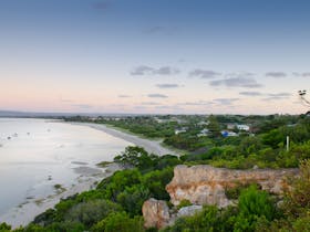
An easy walk along the foreshore from Rye Pier to Canterbury Jetty Road. About a kilometre to the west of Rye Pier is White Cliffs - a rocky cliff outcrop on a small hill. At the base of the outcrop is a reconstructed Lime Burners Kiln that was built as a tribute to one of the major industries for the early settlers in the Rye area. During the mid 1800's, natural limestone was mined in the Rye area. It was then burnt in kilns such as this, to turn it into lime which was then shipped to Melbourne for use in the building industry. The last commercial burning of lime on the Peninsula was carried out in the Rye area. From the reconstructed Limeburners kiln there are steps leading to a lookout area at the top of the cliff, and while it is probably less than one hundred feet high, the views both to the East towards Arthur's Seat and West towards Blairgowrie are quite stunning on a sunny day. To continue towards Blairgowrie you will need to retrace your steps to cross Point Nepean Rd opposite Minnimurra Rd to a shared pathway. The walk then heads towards Blairgowrie. This walk is on a shared pathway for walkers and cyclists that is part of the picturesque 30km Mornington Peninsula Bay Trail along the Port Phillip coast from Safety Beach to Portsea. It connects to the Rye Bay Trail in the east and the Hughes Road to Cameron Bight Bay Trail in the west.
Facilities found here
- Carpark
- Picnic Area
- Public Toilet
Travel Method
- Walk
Route Type
- One way
Difficulty
- Grade 1
Back To Search